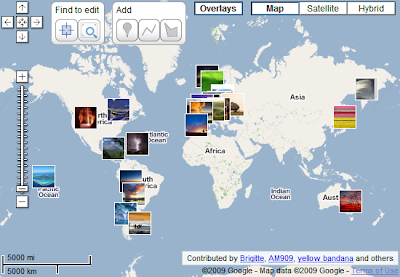
With the latest batch of new features, we now also give users a new way to bring data into Google Map Maker: Overlays. This allows users to overlay kml and image files on top of the map tiles to assist with mapping. A great file to test this feature out with is the Panoramio kml: www.panoramio.com/kml . Adding this kml will drape user-contributed photos on top of your map to give you a ground view no matter where in the world you are mapping. For a full tutorial on how to use the Overlay feature, see Overlay Tutorial.
Posted by Kishore Annapureddy, Software Engineer, and Jessica Pfund, GIS Specialist


 Follow
No comments :
Post a Comment
Note: Only a member of this blog may post a comment.