The official blog for Google Maps
Visit the sets of this year’s Emmy Award nominees on Google Maps
August 21, 2014
Whether you’re into D.C. intrigue or Khaleesi’s conquests, chances are you’re watching the
Emmy Awards
on Monday. To get ready for the show, relive your favorite moments from this year’s
nominees
with Google Maps. Let’s take a peek at a highlight reel of some hot spots and scenes!
If you’re craving ribs after a
House of Cards
binge-watching session, head over to Frank Underwood’s favorite restaurant,
Freddy’s BBQ Rib Joint
, in Baltimore on Street View.
Street View of the filming location of
Freddy’s BBQ Joint
in
Netflix’s House of Cards
More in the mood for afternoon tea? Then visit
Highclere Castle
in North Wessex Downs, where PBS’ critically-acclaimed drama
Downton Abbey
is filmed.
Photo Sphere of
Highclere Castle
, North Wessex Downs, the filming location of PBS’
Downton Abbey
Tired of teaching high school chemistry like our friend Walter White from
AMC’s Breaking Bad
? Well, look no further, because we heard that Albuquerque’s
Los Pollos Hermanos
is hiring.
Street View of the filming location of
Los Pollos Hermanos
in
AMC’s Breaking Bad
Warlords, the Night’s Watch and royalty from all the Seven Kingdoms can agree that the scenery in
HBO’s Game of Thrones
seems like it’s from another world. Google Maps lets you fly over Marrakech to visit
Aït-Ben-Haddou
, the set of Yunkai, one of the cities conquered by the Mother of Dragons,
Daenerys Targaryen
.
Photo of
Aït-Ben-Haddou
, Marrakech, Morocco, filming location of Yunkai in
HBO’s Game of Thrones
Or if political intrigue is more your style, then you might be surprised to learn that
Olivia Pope and Associates
from
ABC’s Scandal
do their fixing at the Palace Theatre in downtown Los Angeles!
Street View of the filming location of
Olivia Pope and Associates
in
ABC’s Scandal
While we can’t get you a ticket to the awards, Google Maps can at least make you feel like an extra on the set of your favorite show. Happy (Street) viewing!
Posted by Susan Cadrecha, Google Maps and TV Fanatic
Explore the geysers and waterfalls of Iceland on Google Maps
August 20, 2014
In his book
Tales of Iceland
, Stephen Markley wrote, “The problem with driving around Iceland is that you’re basically confronted by a new soul-enriching, breath-taking, life-affirming natural sight every five... minutes. It’s totally exhausting.” We've never been ones to take someone else's word for it when it comes to sightseeing, so we took Street View to some of the most stunning locations throughout the country. As it turns out, Markley was right...and now with
Street View
, you can take a journey through Iceland to explore these beautiful places too.
We started with Iceland's "Golden Circle," a famous loop in the southern part of the country. Here’s a look at the famous
Gullfoss Waterfall
on the Hvítá river in the south west of the country. The average amount of water crashing over the falls can reach as much as 140 cubic meters/second at its summertime peak.
Gullfoss Waterfall on Street View
Then, we made the trek to what’s known locally as “Geysir,” or the
Haukadalur Geothermal Area
. Our cameras snapped footage of
Strokkur
, which routinely erupts every five to 10 minutes, and the bigger
Geysir
, which is largely dormant now but used to erupt several times a day. Interestingly, this is
the
geyser that lent its name to the phenomenon in many languages.
Haukadalur Geothermal Area on Street View
We’ve also captured beautiful heritage sites including
Vatnajökulsþjóðgarður
, a national park, and the UNESCO site
Þingvellir
, a place of great historical, cultural and geological
importance
. Iceland's Parliament,
Alþingi
, was established on this site in the year 930, and in 1930 the national park was established to protect the remains.
Þingvellir on Google Street View
And the wonders don’t stop there. Gaze at
Dettifoss
, a waterfall situated in the Vatnajökull National Park and said to be the most powerful waterfall in Europe, or explore
Kerið
, the perfect volcanic crater lake.
Dettifoss Waterfall on Street View
Kerið on Street View
So start your
virtual exploration
now—and it's OK if, like Markley, exhaustion sets in and you need to take a nap in the middle. We—and Iceland's astonishing natural beauty—will be waiting.
Posted by Deanna Yick, Street View Program Manager
Take a college road trip with Street View
August 7, 2014
Whether you’re a college applicant or a curious parent getting to know your kid’s new home away from home, Street View can take you on a walking tour of schools around the world. Starting today, you’ll be able to explore 36 new university campuses across the U.S. and Canada with Street View in Google Maps.
First stop:
Georgetown University
in Washington, D.C. Architecture buffs will love Georgetown's Healy Hall, a
National Historic Landmark
and iconic building in the Romanesque revival style.
Healy Lawn, Georgetown University
Now let’s head south. If a tropical climate is more your speed, maybe the
University of Miami
is the right place for you. Strolling UM’s scenic pathways winding through palm trees and clear blue water, you almost need to put on your shades. Talk about extra credit!
Coral Gables, University of Miami
Finally, let’s stop by the
University of Regina
in Canada. Founded in 1911, the school is known for its emphasis on
experiential learning
. Although its Saskatchewan location can get pretty cold, students can take advantage of the beautiful green when the sun is shining.
Dr. Lloyd Barber Academic Green, University of Regina
These universities are the latest additions to the hundreds of college campuses all over the world that are already available for you to explore in Google Maps. To see if a Street View tour of your dream school is available, search for a particular university on Google Maps and click on
Pegman
to enter the Street View imagery. Visit our
Street View gallery
for global highlights and other popular universities around the world.
So if you can’t make it in person, Street View can help you get a feel for the place you’re considering spending the next four years. And for you parents out there, this might help you get used to the idea of an empty nest!
Posted by Deanna Yick, Street View Program Manager
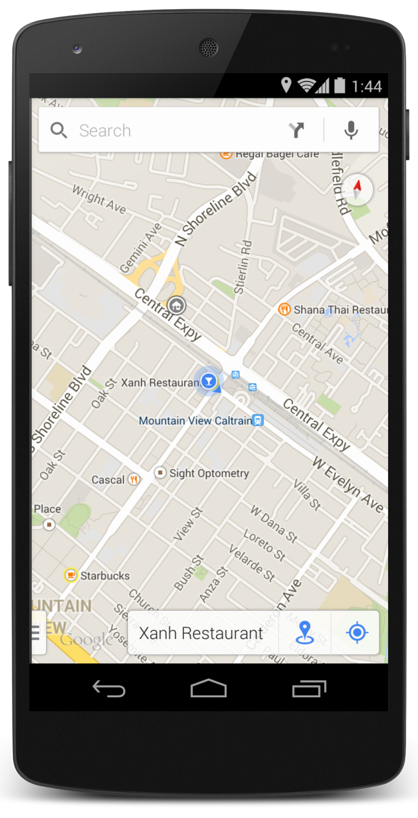
Spend more time exploring with Google Maps
July 23, 2014
On vacation and want to know where the locals go? Looking for a new place to grab food on your lunch break? Waiting on the platform for your next train and wondering when it’s scheduled to arrive? Starting this week, you can spend less time searching for your answer and more time exploring the world with the Google Maps app for Android and iOS.
Now, whenever you want to discover places in your area, simply tap the new Explore button at the bottom right corner of your map to get a quick look at what’s nearby (where available). With Explore as your guide, you’ll see different places and activities that adapt to each area and moment throughout your day. This also works when you’re browsing other neighborhoods and cities on the map so you can plan your day’s outing or daydream about your next vacation.
The results you get in Explore not only tell you what’s nearby—and you can decide if “nearby” means a five-minute walk or a 20-minute drive—but they actually change based on context like the time of day and the weather, too. So don’t worry about wandering over to a breakfast spot for dinner, or arriving at the park just in time for a thunderstorm. You’ll get best results when you’re signed in with
location reporting and history
turned on.
Once you’ve arrived at your destination, you can get even more relevant information. If you’re using an Android device, tap on the My Location button at the bottom right or on the blue dot on the map, and you can quickly access more info about your location such as restaurant reviews and transit schedules, or simply save the place for later. Over time, your location experience will improve as you confirm the places you visit.
So next time you’re deciding where to brunch, or you want to check out your restaurant’s reviews while you wait for friends to arrive, open up your Google Maps app and Explore.
Posted by Taj Campbell, Google Maps Product Manager
Take a swim with Street View on World Oceans Day
June 6, 2014
In celebration of
World Oceans Day
this Sunday, June 8, today we’re inviting you to explore some of the world’s most beautiful and endangered waters in Google Maps, in partnership with
The Catlin Seaview Survey
. All you need is an Internet connection to dive into two new
UNESCO
Marine World Heritage Sites in Belize and the Philippines.
On
UNESCO’s Danger List
of World Heritage Sites, the Belize Barrier Reef is the largest in the northern hemisphere. With Street View, you can discover what’s left of this habitat for threatened species, including many species of coral—everything from brain corals to large gorgonian sea fans.
Half Moon Caye, Belize
Immerse yourself in the waters of Tubbataha Reefs Natural Park, which lies in the middle of the Sulu Sea and is one of the Philippines’ oldest ecosystems. The region contains excellent examples of pristine reef with an incredibly high diversity of marine life. The area supports 374 species of coral (that's almost 90 percent of all coral species in the Philippines!) and numerous sharks, whales and fish.
Tubbataha, Philippines
The Catlin Seaview Survey team has documented many
underwater locales around the world
using their 360-degree panoramic
SVII
cameras, including a growing number of UNESCO Marine World Heritage Sites. We’ll continue to add this imagery to Street View in Google Maps as it’s collected. In the spirit of World Oceans Day, the goal of this project is to expose the world to the beauty of these marine habitats, and to create a scientific baseline record so that their changing health can be monitored over time.
So whether you’re an avid swimmer, a marine biologist or just a curious observer, we encourage you to dive in and explore the ocean with Google Maps—all while staying dry! And you can always see more imagery from around the world by visiting our
complete underwater collection
.
Posted by Jenifer Austin, Manager, Google Ocean Program
Get a front row seat to the games with Google Maps
June 5, 2014
The world's biggest soccer tournament is here. Whether you’re watching from the comfort of your couch or packing your bags for Brazil, Google Maps is your ticket to the games. To kick off the tournament, starting today you can explore all
12 stadiums
and the iconic
painted streets
, one of Brazil’s tournament traditions, in Street View—a digital legacy of the 2014 games for years to come.
Exploring the sights and culture of this year’s football tournament has never been easier with Street View in Google Maps.
Rua Professor Eurico Rabelo - Maracanã, RJ
Rua Padre Agostinho Poncet, São Paulo, Brazil
In addition to the stadiums and painted streets, images from hundreds of sites across
Brazil
, including
Iguaçu National Park
and
St. Michael of the Missions
, are also now available on Google Maps. If what you see in Brazil whets your appetite, you can also explore new Latin American imagery in
Peru
,
Chile
,
Colombia
and
Mexico
.
And if you’re lucky enough to have a physical ticket to Brazil, don’t forget to pack Google Maps for mobile.
Transit
: With Google Maps transit available in all 12 host cities, Brazilians and visitors alike can rest assured they can make it to the stadium and other destinations routing the best path by bus or train.
Indoor Maps:
Make your way through more than 100 venues across Brazil, including airports, shopping malls and, yes, tournament stadiums with Indoor Maps.
Turn-by-turn navigation
: Zip through Brazil from Point A to Point B with Google Maps for mobile, giving you the most accurate traffic info, including real-time incident reports from Waze, and voice-guided directions.
So even if we can't help your favorite team find their way to victory, Google Maps is ready for the assist. You might be (or get) lost without it!
Posted by Deanna Yick, Google Street View Program Manager
Hop on board—and go almost anywhere—with public transit on Google Maps
May 14, 2014
Over 70 percent of the world’s population doesn’t own a car
1
—a surprising fact for anyone who’s sat for what seems like hours on end in bumper-to-bumper traffic. Millions of people rely on public transit to get around. That’s why, since 2007, we’ve worked to include public transit routes and schedules in Google Maps. In fact, buses, trains, trams and subways included in Google Maps travel 200 million kilometers every day—that’s the equivalent of driving every single road in the world three times!
2
Today, Google Maps is helping you get around on public transit even more easily with these additions:
We’ve added
every single transit route
in
Great Britain
to Google Maps—making it easier to get anywhere from Land’s End to John O’Groats.
On the other side of the globe,
Vancouverites
looking for sun can now get real-time updates on whether a bus to Kits is faster than one to Third Beach.
In
Chicago
, Cubs fans can now zip to and from Wrigley Field, armed with the real-time information they need to hop on a bus and avoid congestion on Lake Shore Drive.
And finally, just in time for the games, we’ve
recently added
transit information for every host city in
Brazil
. Can you say “GOOOAAALLLLL?!”
Our transit data spans six continents, 64 countries and more than 15,000 towns and cities worldwide. And we’re not done yet: Google Maps will continue to improve—serving people the information they need to get around town when and where they need it.
Posted by David Tattersall, Product Manager, Public Transit
1
This estimate is based on the most recent
World Bank data
on the number of passenger cars per 1,000 people throughout 100 countries and territories. Passenger cars refer to road motor vehicles, other than two-wheelers, intended for the carriage of passengers and designed to seat no more than nine people (including the driver).
2
CIA World Factbook
Labels
#streetview
#treasuremap
+1
3D
8bitmaps
Adwords Express
Africa
Amazon
Andorra
Android
api
Art Project
Audi
biking
Boost
Boulder
Brazil
Bulgaria
Business Photos
Business View
businesses
Canada
check-in
community
competition
contest
crisis response
Culture
custom maps
developer
Developers
directions
disaster response
discovery
earth outreach
education
Emmy Awards
Enterprise
Estonia
Europe
Explore
Fusion Tables
gadgets
Gibraltar
GMM
google
Google Earth
Google Earth Engine
Google Map Maker
Google Maps
Google Maps API
Google Maps Engine
Google Maps for Mobile
Google Maps Gallery
Google Maps Navigation
Google Maps Transit
Google Places
Google Plus
Google Search
Google Street View
google.org
Google+
googlenew
Grand Canyon
ground truth
Halloween
historical
history
holiday
Hotpot
Hungary
imager
imagery
Indoor Maps
iOS
iPhone
Iraq
Japan
Latitude
Latvia
layers
LBC
Lithuania
London
Making of Maps
Malaysia
Mall of America
Map Maker
Maps Blog
Maps Gallery
mapsgl
Matt Harding
Mexico
Mobile
Monticello
My Maps
my places
my tracks
National Geographic
navigation
new Google Maps
oblique imagery
ocean
offline maps
Olympics
Outreach
Pakistan
Panoramio
Parks Canada
Pegman
Photo Spheres
photo tours
photos
picasa
Polar Bears
Quiz
real estate
restaurants
road trips
Russia
Santa
Santa Tracker
search stories
SketchUp
Slovakia
Slovenia
South Sudan
space
Spain
sports
Street View
summer
SXSW
Tags
Thomas Jefferson
Thomas Jefferson Foundation
Tip of the week
tips
tour guide
traffic
Train
Transit
travel
trees
Trekker
Trike
Trolley
U.S. National Park Service
Ukraine
University of Virginia
Valentine's Day
Veterans Day
Views
voice search
walking
Waze
weather
webgl
Your Timeline
zagat
Archive
2016
Sep
Aug
Jul
Jun
May
Apr
Mar
Feb
Jan
2015
Dec
Nov
Oct
Sep
Aug
Jul
Jun
May
Apr
Mar
Feb
Jan
2014
Dec
Nov
Oct
Sep
Aug
Jul
Jun
May
Apr
Mar
Feb
Jan
2013
Dec
Nov
Oct
Sep
Aug
Jul
Jun
May
Apr
Mar
Feb
Jan
2012
Dec
Nov
Oct
Sep
Aug
Jul
Jun
May
Apr
Mar
Feb
Jan
2011
Dec
Nov
Oct
Sep
Aug
Jul
Jun
May
Apr
Mar
Feb
Jan
2010
Dec
Nov
Oct
Sep
Aug
Jul
Jun
May
Apr
Mar
Feb
Jan
2009
Dec
Nov
Oct
Sep
Aug
Jul
Jun
May
Apr
Mar
Feb
Jan
2008
Dec
Nov
Oct
Sep
Aug
Jul
Jun
May
Apr
Mar
Feb
Jan
2007
Dec
Nov
Oct
Sep
Aug
Jul
Jun
May
Feed
Google
on
Follow @googlemaps
Follow
Give us feedback in our
Product Forums
.


 Follow