The official blog for Google Maps
Remembering Hurricane Katrina
August 27, 2010
Before coming to Google, I worked at a
non-profit organization
that responded to Hurricane Katrina by sending mobile health clinics to the Gulf Coast, where there was critical shortage of medical and mental health care providers. I traveled through the region regularly for nearly two years following the storm and each time I would visit the same spots, trying to get a sense of how they were recovering. In some places I saw rapid change and in others hardly any.
Since moving to California I haven’t been able to get back to the Gulf, but I think about that time often. I was excited back in 2008 when we made
Street View imagery of New Orleans
available, and I’ve kept track of updates to our overhead imagery of the area in Google Earth and Maps.
With the fifth anniversary of Hurricane Katrina approaching, my mind has been with the hardworking and resilient residents of coastal Louisiana and Mississippi. I used the Historical Imagery feature in Google Earth to look back at some of the places I used to visit, and created these slideshows to show the change over time.
These by-now-familiar images of the Lower Ninth Ward are no less heartbreaking today than they were when we first saw them.
The Biloxi Bay Bridge, which connects Biloxi to Ocean Springs, MS, was heavily damaged in the hurricane and had to be rebuilt. The new bridge opened to traffic in November, 2007.
Posted by Kate Hurowitz, Lat Long Blog Team
Go East!
August 27, 2010
The Google Earth and Maps Imagery team has just finished rolling out new imagery across the globe, including a significant amount of aerial imagery in Eastern Europe. It's been a while since we had a big update in that part of the world, and there are a ton of fantastic sights for all you armchair geographers out there to explore. Break out the Slavic dictionary, crank up the techno, and start zooming in!
Wawel Castle, Krakow, Poland
Airport/Racetrack, Dolna Mitropoliya, Bulgaria
Struga, Macedonia
High Resolution Aerial Updates:
USA: Pittsburgh, Kane County (IL)
Poland: Krakow, Tarnow, Nowy Sacz, Bielsko-Biala, Zory, Chorzow, Krosno, Kolbuszowa, Chorzow, Czestochowa, Kielce, Radomsko, Belchatow, Skarzysko-Kamienna, Kielce, Starachowice, Radom, Ostrowiec, Pulawy, Zamosc, Jelenia Gora, Swidnica, Glogow,
Czech Republic: Vysocina, Jihomoravsky, Olomoucky, Moravskoslezsky
Macedonia: entire country
Countries receiving High Resolution Satellite Updates:
Cuba, El Salvador, Costa Rica, Colombia, Venezuela, Peru, Brazil, Bolivia, Argentina, Chile, Uruguay, Morocco, Algeria, Egypt, Senegal, Mali, Guinea, Ivory Coast, Ghana, Murkina Faso, Nigeria, Benin, Chad, Cameroon, Central African Republic, Sudan, Ethiopia, Somalia, Kenya, Tanzania, Zimbabwe, Zambia, Angola, Botswana, South Africa, Madagascar, Saudi Arabia, Oman, Kuwait, Jordan, Israel, Russia, Estonia, Latvia, Lithuania, Hungary, Slovenia, Bulgaria, Iran, Pakistan, India, China, Myanmar, Cambodia, Indonesia, Australia, New Zealand, The Philippines, Japan, North Korea, Mongolia
Countries receiving Medium Resolution Satellite Updates:
Myanmar
These updates are currently only available in Google Earth, but they'll also be in Google Maps soon. To get a complete picture of where we updated imagery, download
this KML
for viewing in
Google Earth
.
Posted by Matt Manolides, Senior Geo Data Strategist
Guidance and Updated Policies for Writing Reviews
August 25, 2010
Three years ago we launched
reviews for places on Google
so that you could share your opinion of any place in the world. Your reviews help other users find places that are right for them.
We encourage you to continue sharing your experiences and opinions -- both good and bad. At the same time, we want to ensure that the information posted in reviews is useful and relevant for everyone. So today, we’ve updated and clarified the
guidelines and policies for writing reviews
. These guidelines help to make sure that reviewers understand how to write thoughtful reviews, that readers will find them informative, and that the content of the reviews provide useful feedback for Google Places business owners. We’re also sharing more information about when and why some reviews may be removed from a Place page. Below is a quick summary of the updates. Be sure to review the
updated policy
for more details.
Tips for writing great reviews
There isn’t an exact formula to writing a great review. Reviews are best when they reflect the unique opinion and viewpoint of an individual. You can share as much or as little information as you’d like: you might choose to describe the intricate details of a restaurant’s decor, or simply recommend your favorite dish. In the updated policy, you’ll find several best practices to consider when reviewing a business. These tips can help you convey your personal opinions clearly and effectively.
Does Google remove reviews?
The short answer is yes. Reviews are intended as a way for people to share useful and relevant information. That encompasses a wide range of opinions, most of which are permitted by our policy. However, in instances in which a review is in violation of our policy, we will remove the review. It’s important to remember that negative reviews aren’t against our policy. We encourage you to share your honest opinions about a business. And if you’re a business owner, you can
directly respond to reviews
to share your side of the story.
The process for reporting a review that violates our policies hasn’t changed. You can still report a review using the
Flag as inappropriate
link found next to each review submitted through Google Maps. When a review is flagged, we'll check to determine if the review violates our guidelines and take action accordingly.
This policy update is our latest step in our ongoing effort to improve your experience with business reviews. We hope you continue to voice your experiences, thoughts and opinions of the places you visit!
Posted by Stephen Seyboth, Product Manager
Street View Imagery Available in Building Maker
August 24, 2010
[Cross-posted from the
SketchUp blog
]
If you’ve ever modeled a building in
Google Building Maker
, you may have found yourself wanting to use crisper, more detailed photos in addition to the aerial oblique imagery. Or, you may have had problems with poor textures caused by other buildings blocking the view of your building. In response to these issues we recently added the ability to
add your own photos to Building Maker
, but now you can also use imagery directly from
Street View on Google Maps
!
Start modeling your building using the aerial imagery. After you have constrained a block in at least two aerial images, you will be able to “Add Street View Images” from a drop down menu on the left-hand side. Capture a few images from Street View and continue modeling as normal. The following video illustrates an example of using this new feature:
We have also added 6 new cities to Building Maker (all, with the exception of Vienna, have Street View imagery!):
Edinburgh, United Kingdom
Florence, Italy
Vienna, Austria
Pittsburgh, PA, United States
Santa Cruz, CA, United States
Riverside, CA, United States
Try modeling with Street View imagery in
Google Building Maker
now!
Posted by Nicole Drobeck, Geo Community Advocate
Dive into the ocean with Google Earth for Android
August 23, 2010
Especially during the summer months, staring out into the ocean leads to daydreams of sailing the open water, freedom and exploration. Now you can take three-quarters of this vast planet - the ocean - with you on your mobile device by downloading the new Google Earth 1.1 for Android.
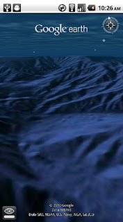
With the release of this feature, you can escape the hustle and bustle of life on land and discover the marine world using Google Earth on your mobile device. For example, check out the landscape and terrain in Monterery Bay Canyon, which is larger than the Grand Canyon, by zooming in on Google Earth below the ocean surface just off the coast. Once underwater, you can use the “look around” button to tilt the view and see the extent of this great undersea canyon.
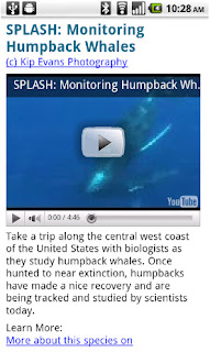
The latest version of Google Earth for Android also introduces the “Explore the Ocean” layer, which features hundreds of photos and videos from more than 100 contributors who are excited to share their stories of the sea. Plan or get a sneak peek of your next vacation during your daily commute by clicking on any of the little blue icons. The gold highlighted icons represent content from the
Mission Blue Hope Spot initiative
.
For those of you running Android 2.2, there are some more treats in store. Google Earth now supports Flash in balloons, so if you have the Flash player installed on your mobile device, you can watch videos right in the balloon. We’ve also made the program easier to navigate; for most devices, you can now use two fingers to “look around” and change your viewpoint, as an alternate to using the on-screen button. This makes it even easier to tilt your view to see mountainous landscapes or underwater canyons.
Google Earth for Android 1.1
is available in the Android Market today for most Android devices running version 2.1 or later. Explore the ocean anywhere.
Posted by Jenifer Austin Foulkes, Product Manager
To 100 million and beyond with Google Maps for mobile
August 19, 2010
[Cross-posted from the
Google Mobile Blog
]
Almost five years ago, we launched
Google Maps for mobile
to help you get where you needed to go from your phone instead of a paper map. Today, more than 100 million people a month are now using Google Maps for mobile to get from point A to point B, find nearby places, and more.
Over the past five years, Maps for mobile has changed quite a bit, adding more ways to help you explore the world around you. With
My Location
, you can quickly find where you are on the map with or without GPS. You can put your friends on the map with
Latitude
.
Navigation
even turns your phone into a free internet-connected navigation system with voice guidance and Street View imagery.
Lately, we’ve been especially focused on helping you find the right place at the right time. With recent additions such as Place Pages, you can now pick a nearby place by browsing information such as opening hours and review snippets for the places around you. It’s easier than ever to find those places with
Search by voice
or the
new Places icon on Android
. With this latest Android version, we’re happy to see that you’re now searching for places almost three times as often, doubling how many Place Pages are seen a day.
Search result page for Java-enabled phones in 2005 (left) and Place Page for Android-powered devices in 2010 (right).
Search experience in 2005 (left) and Places for Android-powered devices in 2010 (right).
We hope this is just the start of how Google Maps for mobile will continue to evolve and let you explore the world right from your phone. We’re always inspired by how you’re using Maps, and we’d love to hear about a time when you found the nearest mechanic for a flat tire or discovered that hidden gem of a burger joint. If you have a
Google story
about when Maps for mobile has helped you, please
tell us about it
. You can also share quick stories on Twitter
@googlemobile
, and we’ll share our favorite ones. From all of us here on the Google Maps for mobile team, 100 million thank yous for getting your Google Maps to go!
If you’re a business owner, help millions of people find you by claiming your free Place Page available in Google Maps and our most used mobile “app” -- Google Search. Get started at
places.google.com/businesses
.
Posted by Vic Gundotra, Vice President of Engineering
Heroic Defenders of Wildlife organization maps oil spill cleanup efforts
August 19, 2010
Update: please visit the
Conservation Registry
for an updated map of the Gulf Oil Spill relief efforts.
For a period of several months, 50,000 to 60,000 barrels of oil per day flowed from the site of the Deepwater Horizon well straight into the Gulf of Mexico. After the initial explosion on April 20th, the first reports of oil sightings on the coastlines began on June 1st. People living and working along the shoreline spanning Louisiana, Mississippi, Alabama and Florida saw clumps of crude oil on their local beaches. That was followed by reports of birds, dolphins, fish and sea turtles covered in slick black oil.
In the aftermath of the largest environmental disaster in U.S. history, environmental groups across the country have been rallying in support of both immediate coastal reparation and long-term solutions for the damage the Gulf Oil Spill has wreaked on the ecosystem. With those goals in mind, Washington, D.C.-based
Defenders of Wildlife
, an organization dedicated to protecting species and the habitats on which they depend, is doing everything it can to raise awareness and action for greater cleanup and conservation.
The organization is working to educate policymakers about the importance of protecting wildlife and securing a moratorium on further offshore drilling. In addition, Defenders of Wildlife has been issuing
ongoing reports
on the number of birds, sea turtles and marine mammals found covered in oil along the coast. As many as 400 different species of animals are projected to be impacted by the environmental nightmare. Since massive cleanup activities are being led by a number of environmental groups, Defenders of Wildlife also decided to use their powerful mapping platform called the
Conservation Registry
to track the collective efforts of all the various groups into one comprehensive map.
Oiled Wildlife Ticker, updated each day to track the numbers of animals that have been impacted by the spill
This
Gulf Oil Spill Recovery map
was created using the Google Maps API and the Google Earth API. It allows any users, whether they’re part of a non-profit group or concerned citizens who want to report what they observe in their backyards, to upload stories, photos and video to the common shared map. The result is an impressive illustration of all the projects - from beach cleanups to air monitoring surveys to sediment sampling - going on in the region to help rescue and restore affected species and their habitats. The map also shows numerous steps that the Obama Administration is taking to mitigate the near- and long-term impacts of the spill. As the map evolves, you’ll be able to see how the marine environment and coastlines recuperate from collaborative efforts by average people, non-profit organizations and government agencies.
Through this video, our most recent
Google Earth Hero
, Defenders of Wildlife, shares more about the creation of the Gulf Oil Spill Recovery application. Their hope is that it will not only help people visually understand the scope of the spill and recovery work, but also spur volunteers into taking action and getting involved themselves. Additional data contributed by Defenders of Wildlife, news and user videos can also be found on the
Google Crisis Response oil spill recovery site
.
Posted by Tanya Keen, Google Earth Outreach Program Manager
Labels
#streetview
#treasuremap
+1
3D
8bitmaps
Adwords Express
Africa
Amazon
Andorra
Android
api
Art Project
Audi
biking
Boost
Boulder
Brazil
Bulgaria
Business Photos
Business View
businesses
Canada
check-in
community
competition
contest
crisis response
Culture
custom maps
developer
Developers
directions
disaster response
discovery
earth outreach
education
Emmy Awards
Enterprise
Estonia
Europe
Explore
Fusion Tables
gadgets
Gibraltar
GMM
google
Google Earth
Google Earth Engine
Google Map Maker
Google Maps
Google Maps API
Google Maps Engine
Google Maps for Mobile
Google Maps Gallery
Google Maps Navigation
Google Maps Transit
Google Places
Google Plus
Google Search
Google Street View
google.org
Google+
googlenew
Grand Canyon
ground truth
Halloween
historical
history
holiday
Hotpot
Hungary
imager
imagery
Indoor Maps
iOS
iPhone
Iraq
Japan
Latitude
Latvia
layers
LBC
Lithuania
London
Making of Maps
Malaysia
Mall of America
Map Maker
Maps Blog
Maps Gallery
mapsgl
Matt Harding
Mexico
Mobile
Monticello
My Maps
my places
my tracks
National Geographic
navigation
new Google Maps
oblique imagery
ocean
offline maps
Olympics
Outreach
Pakistan
Panoramio
Parks Canada
Pegman
Photo Spheres
photo tours
photos
picasa
Polar Bears
Quiz
real estate
restaurants
road trips
Russia
Santa
Santa Tracker
search stories
SketchUp
Slovakia
Slovenia
South Sudan
space
Spain
sports
Street View
summer
SXSW
Tags
Thomas Jefferson
Thomas Jefferson Foundation
Tip of the week
tips
tour guide
traffic
Train
Transit
travel
trees
Trekker
Trike
Trolley
U.S. National Park Service
Ukraine
University of Virginia
Valentine's Day
Veterans Day
Views
voice search
walking
Waze
weather
webgl
Your Timeline
zagat
Archive
2016
Sep
Aug
Jul
Jun
May
Apr
Mar
Feb
Jan
2015
Dec
Nov
Oct
Sep
Aug
Jul
Jun
May
Apr
Mar
Feb
Jan
2014
Dec
Nov
Oct
Sep
Aug
Jul
Jun
May
Apr
Mar
Feb
Jan
2013
Dec
Nov
Oct
Sep
Aug
Jul
Jun
May
Apr
Mar
Feb
Jan
2012
Dec
Nov
Oct
Sep
Aug
Jul
Jun
May
Apr
Mar
Feb
Jan
2011
Dec
Nov
Oct
Sep
Aug
Jul
Jun
May
Apr
Mar
Feb
Jan
2010
Dec
Nov
Oct
Sep
Aug
Jul
Jun
May
Apr
Mar
Feb
Jan
2009
Dec
Nov
Oct
Sep
Aug
Jul
Jun
May
Apr
Mar
Feb
Jan
2008
Dec
Nov
Oct
Sep
Aug
Jul
Jun
May
Apr
Mar
Feb
Jan
2007
Dec
Nov
Oct
Sep
Aug
Jul
Jun
May
Feed
Google
on
Follow @googlemaps
Follow
Give us feedback in our
Product Forums
.




 Follow
