Keeping Earth up to date and looking great


Three years ago we introduced a cloud-free mosaic of the world in Google Earth. Today we’re rolling out an even more beautiful and seamless version, with fresh imagery from Landsat 8 satellite and new processing techniques for sharper images than ever before. Satellite images are often cloudy, but not always over the same place, so we looked at millions of images and took the clearest pixels to stitch together this cloud-free and seamless image.
-
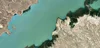
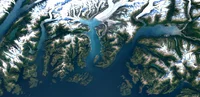 Columbia Glacier, Alaska
 -
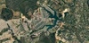
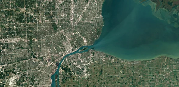 Detroit, Michigan
 -
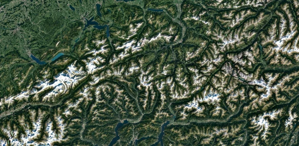 Swiss Alps, Switzerland
Higher Quality Imagery
Landsat 8, which launched into orbit in 2013, is the newest sensor in the USGS/NASA Landsat Program — superior to its predecessors in many ways. Landsat 8 captures images with greater detail, truer colors, and at an unprecedented frequency — capturing twice as many images as Landsat 7 does every day. This new rendition of Earth uses the most recent data available — mostly from Landsat 8 — making it our freshest global mosaic to date.

Our previous mosaic used imagery from Landsat 7 only, which at the time was the best imagery of its kind. Unfortunately, Landsat 7 images captured after 2003 were affected by a hardware failure, resulting in large diagonal gaps of missing data You can see this effect in the subsets of two Landsat 7 images captured over Oklahoma City, OK, in 2000 and 2003.

Processing imagery with Earth Engine
To produce this new imagery, we used the same publicly available Earth Engine APIs that scientists use to do things like track global tree cover, loss, and gain; predict Malaria outbreaks; and map global surface water over a 30 year period. Like our previous mosaic, we mined data from nearly a petabyte of Landsat imagery — that’s more than 700 trillion individual pixels — to choose the best cloud-free pixels. To put that in perspective, 700 trillion pixels is 7,000 times more pixels than the estimated number of stars in the Milky Way Galaxy, or 70 times more pixels than the estimated number of galaxies in the Universe.