Tōhoku in pictures: Five years after the Great East Japan earthquake and tsunami
You can now see updated Street View imagery from 59 cities, 19 towns and 4 villages from the Ibaraki, Iwate, Fukushima and Miyagi prefectures, which was collected between June 2015 and January 2016. Part of the “Great East Japan Earthquake Digital Archive Project," this is the third Street View imagery update since the disaster.

By using Street View technology to record, exhibit and archive the damage, we hope to give people—both those who used to live there, and those who have never been—a way to see and understand the destruction caused by the earthquake and tsunami. It may also give future generations a vivid way to understand and remember what happened.
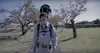
One of the areas most affected by the disaster was Fukushima prefecture. Naraha in Fukushima was an evacuation zone until September of last year, but is now being rebuilt and repopulated. The people of Naraha wanted to capture this rebuilding process, so they borrowed the Street View Trekker as part of the Trekker loan program so they could show the world what Naraha looks like today and share their hopes for the future.
In addition to the updated Street View imagery, we also have satellite and aerial imagery of the coast stretching from Hachinohe to Iwaki from before and after the disaster. As this timelapse with scenes from the Iwate, Miyagi and Fukushima prefectures shows, the road to recovery is a long one.
震災から 5 年。 震災前からこれまでの東北の姿。
Miyako was one of the areas most devastated by the tsunami, with waters reaching at least 37.9 meters above sea level. The seaside town was filled with homes and businesses before the earthquake struck in 2011. Everything was swept away by the tsunami. Clearing the rubble from the disaster took years; today, most of the new houses are being built on top of the mountain, not by the sea, in case of a future tsunami.